Guides
How Is Hispaniola Divided? Dominican Republic & Haiti
How Is the Island of Santo Domingo Divided? The Straight Answer
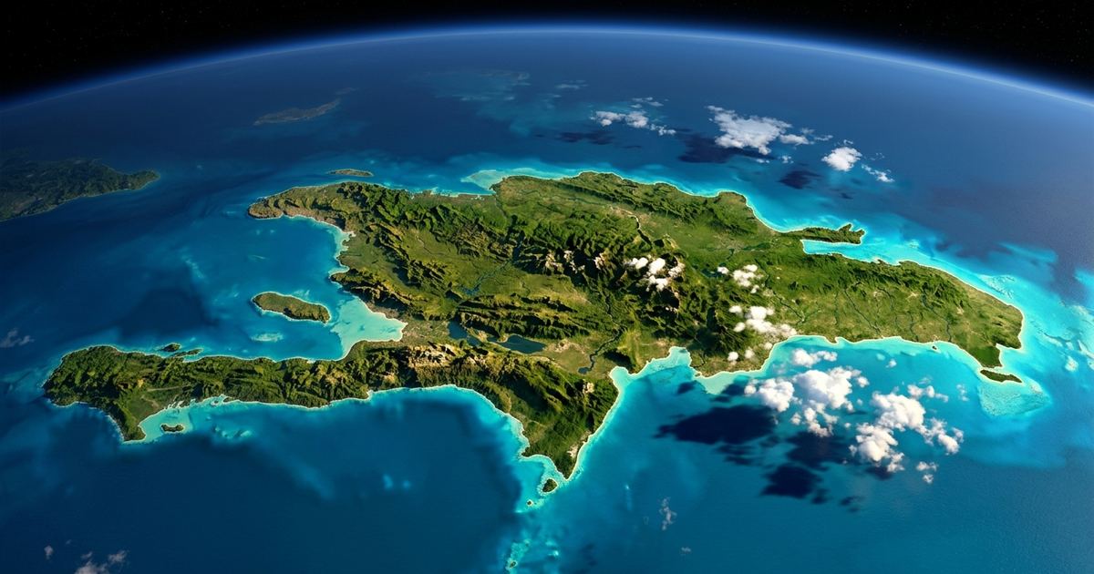
The island of Santo Domingo, officially known as La Española (Hispaniola), is politically divided into two sovereign countries: the Dominican Republic occupies roughly two-thirds of the territory in the east (about ~48,442 km²) and Haiti occupies the western third (about ~27,750 km²). They are separated by a land border of approximately 390 kilometers. This is the only island in the Caribbean that houses two independent nations.
The Island with Two Names (and Two Countries)
You may have heard it called “Isla de Santo Domingo,” “La Española,” or “Hispaniola.” All three names are valid, though the official one is La Española (Hispaniola in English). The traditional name “Isla de Santo Domingo” comes from colonial times, when the entire island was known by the name of its capital founded by the Spanish. And these are not the only ones: the island has accumulated at least six names throughout its history, as I explain in How Many Names Has the Island of Santo Domingo Had?.
With ~76,192 km², it is the second-largest island in the Antilles, surpassed only by Cuba. Its size and strategic location made it the first permanent European settlement in the Americas, and today it is home to more than 22 million people spread across two countries with deeply different histories, languages, and cultures, but united by the same land.
The Current Political Division
For a clear overview, here are the essential facts for each country:
| Country | Area (approx.) | % of the island | Capital | Official Language(s) | Currency |
|---|---|---|---|---|---|
| Dominican Republic | ~48,442 km² | ~64% | Santo Domingo | Spanish | Dominican peso (DOP) |
| Haiti | ~27,750 km² | ~36% | Port-au-Prince | Haitian Creole and French | Gourde (HTG) |
As you can see, the Dominican Republic is clearly the larger country, but Haiti has a much higher population density. Both coexist on the same island, but with very different realities.
Where Does the Border Run?
The border between the Dominican Republic and Haiti runs across the island from north to south for roughly ~390 km. It is not a straight line: it follows the course of rivers, hills, and geographic features.
The two rivers that mark the extremes of the border are:
- Río Masacre (or Dajabón) in the north.
- Río Pedernales in the south.
On the Dominican side, the border provinces are Dajabón, Elías Piña, Independencia, Pedernales, and Montecristi. There, daily life is marked by commercial and cultural exchange.
Fun fact: In Dajabón, a famous binational market operates on Mondays and Fridays, where Dominicans and Haitians trade food, clothing, and basic goods. It’s a spectacle of color, bustle, and brotherhood that few tourists know about.
How Did the Division Happen? Timeline
The division of the island was not a single event but the result of centuries of colonial conflicts, treaties, and wars. Here is a summary of the key milestones:
- 1492 – Christopher Columbus arrives on the island, baptized as La Española. The Spanish colony is established.
- 1697 – Treaty of Ryswick: Spain officially recognizes France’s possession of the western third of the island, which becomes the colony of Saint-Domingue (present-day Haiti).
- 1777 – Treaty of Aranjuez: Spain and France delimit the border between the two colonies for the first time.
- 1795 – Treaty of Basel: Spain also cedes the eastern part (present-day Dominican Republic) to France.
- 1804 – Haiti gains independence from France after a slave revolution.
- 1822-1844 – Haiti militarily occupies the entire island, including the eastern part.
- 1844 – The Dominican Republic becomes independent from Haiti, re-establishing its sovereignty in the east.
- 1929 and 1936 – The Domínguez-Boyer Treaty (1929) and its revision (1936) are signed, setting the definitive border we know today.
Since then, the division has remained stable, though relations between the two countries have had their ups and downs.
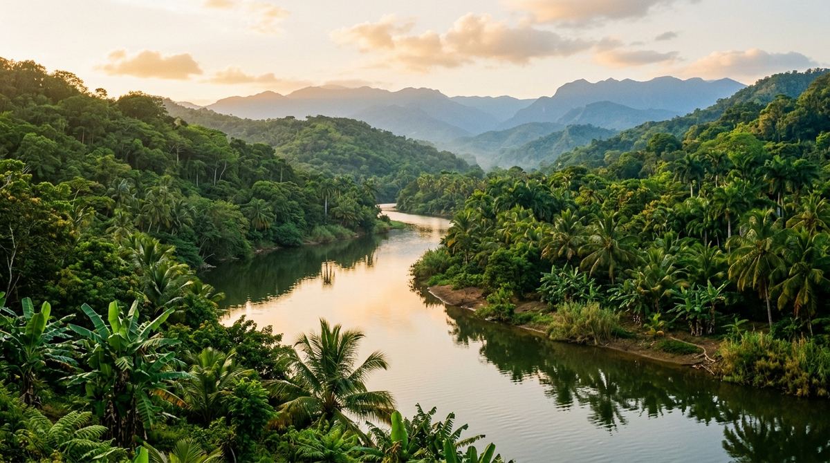
Geography of the Island in Facts
To close with a geographic flourish, here is a mini-table with the island’s records:
| Feature | Fact |
|---|---|
| Total area | ~76,192 km² |
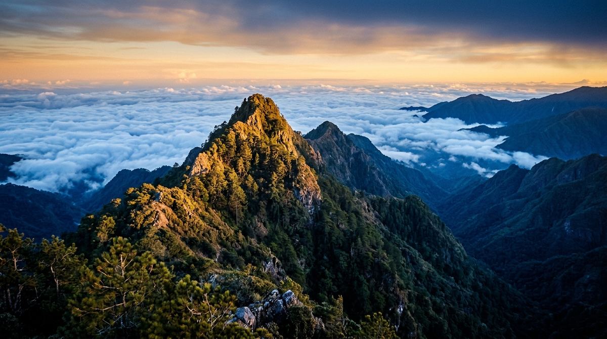
| Highest point | Pico Duarte (~3,098 m), in the Dominican Republic. It is the highest mountain in the Caribbean. |
| Lowest point | Lake Enriquillo (~40 m below sea level), also in the Dominican Republic. It is the lowest point in the Caribbean. |
| Border length | ~390 km |
So, if you ever climb Pico Duarte or visit Lake Enriquillo (where American crocodiles live), you’ll be stepping on places that are unique in all the Caribbean.
Why Does a Restaurant Talk About Geography?
Good question. At Valerio Burger Club (VBC) , in El Millón, Santo Domingo, we are not only passionate about good meat, artisan bread, and homemade sauces. We also love sharing curious facts about the island that hosts us. And if you’re visiting, my Santo Domingo tipping guide will come in handy so you can move around like a local.
We welcome Dominican students who want to learn more about their own country, and curious tourists who show up asking, “Hey, is this Santo Domingo or the Dominican Republic?” This article is to answer that question once and for all, with clear data and respect for both nations.
If you come to explore the Colonial Zone, the Malecón, or just to walk around El Millón, stop by VBC. Order a Valerio Burger or a Smash Burger with truffle fries. And if you can’t come in person, we always have delivery. We’re waiting for you with the best burger in Santo Domingo and a good story to tell.
Frequently Asked Questions (FAQ)
Which countries make up the island of Santo Domingo?
The island of Santo Domingo (Hispaniola) is made up of two countries: the Dominican Republic (in the east, ~64% of the territory) and Haiti (in the west, ~36%).
What is the island really called: Santo Domingo, La Española, or Hispaniola?
The official name is La Española (Hispaniola in English). “Isla de Santo Domingo” is a traditional name commonly used, especially in the Dominican context. All three names are accepted, but the geographically correct one is La Española.
When was the island divided into two colonies?
The colonial division began in 1697 with the Treaty of Ryswick, when Spain recognized French possession of the western third. The definitive border was set in the treaties of 1929 and 1936.
How many kilometers is the border between the Dominican Republic and Haiti?
The land border is approximately 390 kilometers long, largely marked by the Masacre River (north) and the Pedernales River (south).
What is the largest island in the Antilles?
The largest island in the Antilles is Cuba, with ~109,884 km². Hispaniola is the second largest, with ~76,192 km².
From the blog to your table
In Santo Domingo? Don't read on an empty stomach.
Order your favorite burger from Valerio Burger Club and we’ll deliver it to your door. Beef ground daily, artisan buns and house-smoked meats.
Keep reading
 Guides
 Bunless Burger: Lettuce Wrap, Protein Style & Calories
What a bunless burger is called, how many calories it has (component table), and 3 ways to make one at home with a step-by-step lettuce wrap recipe.
 Guides
 Tipping in Santo Domingo: Complete Guide 2026
Complete guide to tipping in the Dominican Republic: the legal 10% tip, 18% ITBIS, how much extra to leave at restaurants, and tips for tourists.
 Guides
 How Many Names Has Hispaniola Had?
Hispaniola has carried many names: the Taíno Haití, Quisqueya and Bohío, Columbus's La Española, Santo Domingo and Saint-Domingue. Here's the story.